![](/images/other/stat-length.png)
![Randonnée A pied Gemeinde Aspang - Unteraspang - Saurerhütte - Photo](https://media.geolcdn.com/t/1900/400/37088529-8721-4633-b41a-c40d57bcc49b.jpeg&format=pjpeg&maxdim=2)
Unteraspang - Saurerhütte
SityTrail - itinéraires balisés pédestres
Tous les sentiers balisés d’Europe GUIDE+
![Longueur](/images/other/stat-length.png)
Longueur
4 km
![Altitude max](https://static1.geolcdn.com/siteimages/upload/files/1508320355ic_sort_altitude_max_24dp.png)
Altitude max
728 m
![Dénivelé positif](https://static1.geolcdn.com/siteimages/upload/files/1508320355ic_sort_den_pos_24dp.png)
Dénivelé positif
272 m
![Km-Effort](/images/other/stat-length.png)
Km-Effort
6,8 km
![Altitude min](https://static1.geolcdn.com/siteimages/upload/files/1508320355ic_sort_altitude_min_24dp.png)
Altitude min
465 m
![Dénivelé négatif](https://static1.geolcdn.com/siteimages/upload/files/1508320355ic_sort_den_neg_24dp.png)
Dénivelé négatif
21 m
![Boucle](https://static1.geolcdn.com/siteimages/upload/files/16400158638029165_repeat_loop_refresh_sync_direction_icon.png)
Boucle
Non
Balise
Date de création :
2022-02-16 16:42:12.033
Dernière modification :
2022-03-03 10:44:10.599
![A pied](https://static1.geolcdn.com/sitytour/trail-icons/100.png)
1h32
Difficulté : Facile
![Scannez ce code QR pour ouvrir la randonnée dans l'application SityTrail](https://capi.geolives.com/qq0zvz2zws4bq2lad0pu/sitytour/trails/3127566/qr.png?size=200)
Application GPS de randonnée GRATUITE
À propos
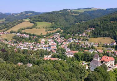
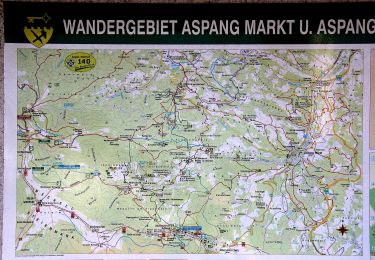
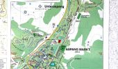
Randonnée A pied de 4 km à découvrir à Basse-Autriche, Bezirk Neunkirchen, Gemeinde Aspang. Cette randonnée est proposée par SityTrail - itinéraires balisés pédestres.
Description
Symbole: blauer,waagrechter Balken
Localisation
Pays :
Autriche
Région :
Basse-Autriche
Département/Province :
Bezirk Neunkirchen
Commune :
Gemeinde Aspang
Localité :
Unknown
Départ:(Dec)
Départ:(UTM)
582639 ; 5268947 (33T) N.
Commentaires
Randonnées à proximité
![Randonnée A pied Feistritz am Wechsel - Rundwanderweg 10 (Urban-Kapelle - Feistritz - Grottendorf - Hollabrunn - Urban-Kapelle) - Photo](https://media.geolcdn.com/t/375/260/3b2c8ecd-1b3c-45ac-a950-85a706da3537.jpeg&format=jpg&maxdim=2)
![A pied A pied](https://static1.geolcdn.com/sitytour/trail-icons/100.png)
Rundwanderweg 10 (Urban-Kapelle - Feistritz - Grottendorf - Hollabrunn - Urba...
A pied
Facile
Feistritz am Wechsel,
Basse-Autriche,
Bezirk Neunkirchen,
Autriche
![](/images/other/stat-length.png)
11,2 km | 16,6 km-effort
3h 45min
![](https://static1.geolcdn.com/siteimages/upload/files/16400158638029165_repeat_loop_refresh_sync_direction_icon.png)
Non
![Randonnée A pied Feistritz am Wechsel - Feistritz am Wechsel - Hollabrunn über Steinbichel - Photo](https://media.geolcdn.com/t/375/260/69173b9b-3432-4d70-9800-dbb92f0fc1ba.jpeg&format=jpg&maxdim=2)
![A pied A pied](https://static1.geolcdn.com/sitytour/trail-icons/100.png)
Feistritz am Wechsel - Hollabrunn über Steinbichel
A pied
Facile
Feistritz am Wechsel,
Basse-Autriche,
Bezirk Neunkirchen,
Autriche
![](/images/other/stat-length.png)
4,7 km | 7,9 km-effort
1h 47min
![](https://static1.geolcdn.com/siteimages/upload/files/16400158638029165_repeat_loop_refresh_sync_direction_icon.png)
Non
![Randonnée A pied Gemeinde Krumbach - Ponholz - Kühriegel - Weißes Kreuz - Photo](https://media.geolcdn.com/t/375/260/b18087fc-2312-456a-954f-8d0fc6f8bcaf.jpeg&format=jpg&maxdim=2)
![A pied A pied](https://static1.geolcdn.com/sitytour/trail-icons/100.png)
Ponholz - Kühriegel - Weißes Kreuz
A pied
Moyen
Gemeinde Krumbach,
Basse-Autriche,
Bezirk Wiener Neustadt,
Autriche
![](/images/other/stat-length.png)
16,1 km | 24 km-effort
5h 20min
![](https://static1.geolcdn.com/siteimages/upload/files/16400158638029165_repeat_loop_refresh_sync_direction_icon.png)
Oui
![Randonnée A pied Gemeinde Aspangberg-St.Peter - Aspangberg St. Peter - Grüne Wiese - Photo](https://media.geolcdn.com/t/375/260/a7e6e6cf-4c98-4c1d-a9ee-6844dd2bb28c.jpeg&format=jpg&maxdim=2)
![A pied A pied](https://static1.geolcdn.com/sitytour/trail-icons/100.png)
Aspangberg St. Peter - Grüne Wiese
A pied
Facile
Gemeinde Aspangberg-St.Peter,
Basse-Autriche,
Bezirk Neunkirchen,
Autriche
![](/images/other/stat-length.png)
3,6 km | 6 km-effort
1h 21min
![](https://static1.geolcdn.com/siteimages/upload/files/16400158638029165_repeat_loop_refresh_sync_direction_icon.png)
Non
![Randonnée A pied Gemeinde Aspang - Unteraspang - Hottmannsgraben - Paßkapelle - Photo](https://media.geolcdn.com/t/375/260/8d66704e-3515-4205-b695-dbda7cfcd308.jpeg&format=jpg&maxdim=2)
![A pied A pied](https://static1.geolcdn.com/sitytour/trail-icons/100.png)
Unteraspang - Hottmannsgraben - Paßkapelle
A pied
Facile
Gemeinde Aspang,
Basse-Autriche,
Bezirk Neunkirchen,
Autriche
![](/images/other/stat-length.png)
4,7 km | 7,6 km-effort
1h 43min
![](https://static1.geolcdn.com/siteimages/upload/files/16400158638029165_repeat_loop_refresh_sync_direction_icon.png)
Non
![Randonnée A pied Feistritz am Wechsel - Feistritz am Wechsel - Hollabrunner Riegel (Gasthof zur Schönen Aussicht) - Eben - Kirchau - Photo](https://media.geolcdn.com/t/375/260/ff45a38c-3e21-4a97-9220-0ffaac5f52b2.jpeg&format=jpg&maxdim=2)
![A pied A pied](https://static1.geolcdn.com/sitytour/trail-icons/100.png)
Feistritz am Wechsel - Hollabrunner Riegel (Gasthof zur Schönen Aussicht) - E...
A pied
Facile
Feistritz am Wechsel,
Basse-Autriche,
Bezirk Neunkirchen,
Autriche
![](/images/other/stat-length.png)
10,1 km | 16,5 km-effort
3h 44min
![](https://static1.geolcdn.com/siteimages/upload/files/16400158638029165_repeat_loop_refresh_sync_direction_icon.png)
Non
![Randonnée A pied Gemeinde Aspang - Kleiner Königsbergweg (Aspang Markt) - Photo](https://media.geolcdn.com/t/375/260/4ca19e0f-af8e-427a-a54c-f08e95e9ad0b.jpeg&format=jpg&maxdim=2)
![A pied A pied](https://static1.geolcdn.com/sitytour/trail-icons/100.png)
Kleiner Königsbergweg (Aspang Markt)
A pied
Facile
Gemeinde Aspang,
Basse-Autriche,
Bezirk Neunkirchen,
Autriche
![](/images/other/stat-length.png)
5,2 km | 7,3 km-effort
1h 39min
![](https://static1.geolcdn.com/siteimages/upload/files/16400158638029165_repeat_loop_refresh_sync_direction_icon.png)
Non
![Randonnée A pied Gemeinde Aspangberg-St.Peter - Haltestelle Feistritz- Kirchberg - Kreuzbauer - Photo](https://media.geolcdn.com/t/375/260/4548a801-56e6-4d8d-8463-cda059e9bc70.jpeg&format=jpg&maxdim=2)
![A pied A pied](https://static1.geolcdn.com/sitytour/trail-icons/100.png)
Haltestelle Feistritz- Kirchberg - Kreuzbauer
A pied
Facile
Gemeinde Aspangberg-St.Peter,
Basse-Autriche,
Bezirk Neunkirchen,
Autriche
![](/images/other/stat-length.png)
3,1 km | 6,2 km-effort
1h 23min
![](https://static1.geolcdn.com/siteimages/upload/files/16400158638029165_repeat_loop_refresh_sync_direction_icon.png)
Non
![Randonnée A pied Gemeinde Aspang - Großer Königsbergweg (Aspang Markt) - Photo](https://media.geolcdn.com/t/375/260/376dd4ce-a305-439b-ba04-128f39ee9ebc.jpeg&format=jpg&maxdim=2)
![A pied A pied](https://static1.geolcdn.com/sitytour/trail-icons/100.png)
Großer Königsbergweg (Aspang Markt)
A pied
Facile
Gemeinde Aspang,
Basse-Autriche,
Bezirk Neunkirchen,
Autriche
![](/images/other/stat-length.png)
9,5 km | 14,2 km-effort
3h 14min
![](https://static1.geolcdn.com/siteimages/upload/files/16400158638029165_repeat_loop_refresh_sync_direction_icon.png)
Oui